-1783304403050.jpg)
Behind the 'living map' delivering preventive healthcare with geospatial tech
By Oracle
The Living Asset Map, co-developed by the SingHealth Community Hospitals and Singapore Land Authority, showcases how interagency collaboration and geospatial tech are key enablers to a healthier future.
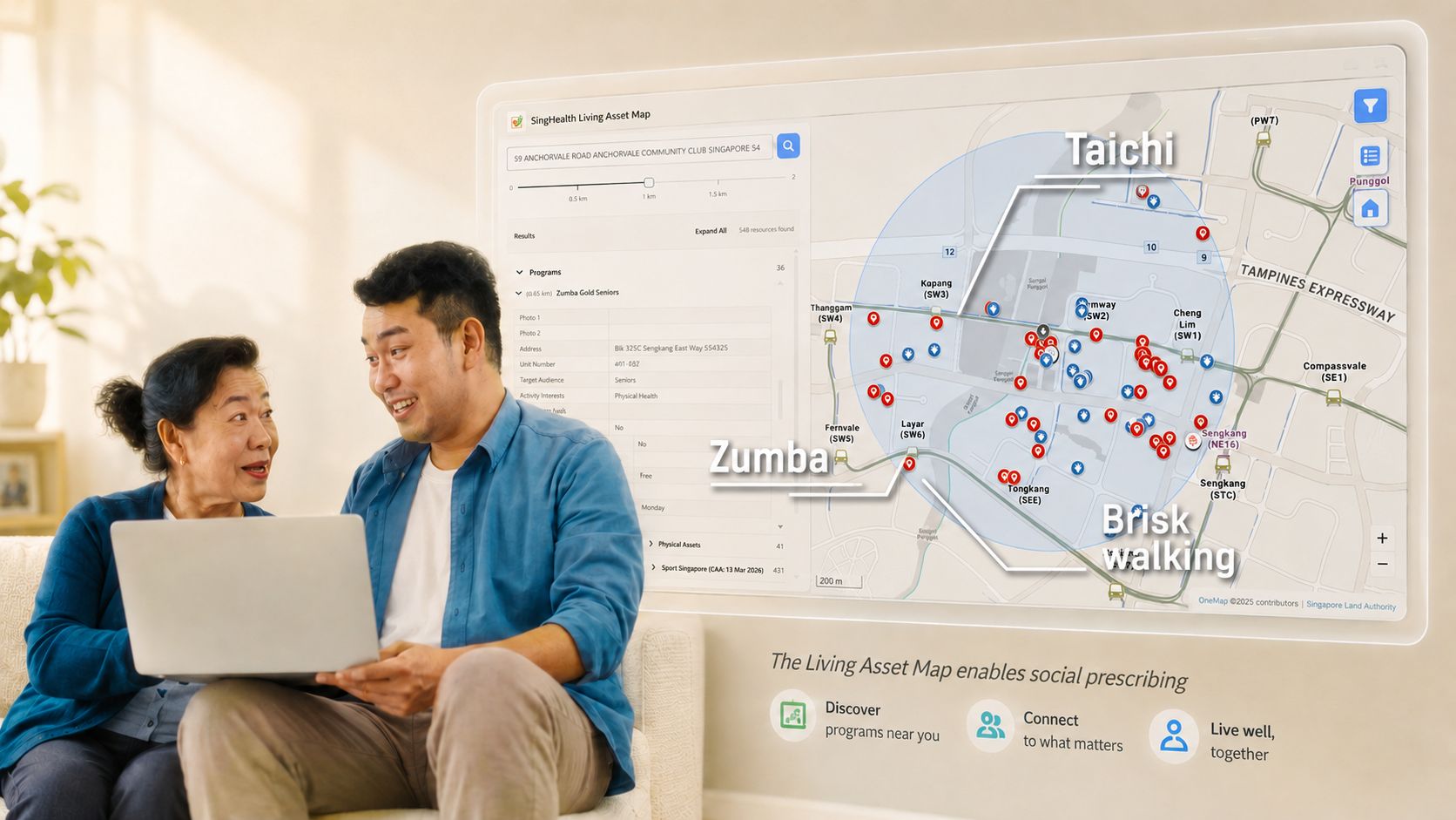
The Living Asset Map harnesses crowdsourced data to support social prescribing at SingHealth Community Hospitals. Image: SingHealth Community Hospitals
The path to recovery after a hospital stay involves more than just medication.
An hour of Tai Chi in the park before breakfast, a Zumba class at the community centre after lunch, and a stroll around the block before bedtime - these activities aren’t merely recreational but serve as valuable resources in Singapore’s push towards preventive healthcare.
Since March 2025, the Living Asset Map (LAMP) made these resources more accessible through a partnership between SingHealth Community Hospitals (SCH) and the Singapore Land Authority (SLA).
LAMP is a dynamic asset mapping methodology that leverages geospatial technology to capture crowdsourced information gathered during community walks by SCH’s staff and volunteers.
The map supports SingHealth’s social prescribing model, which complements clinical prescriptions alongside social support available in the local community – support that, prior to LAMP, largely flew under the radar of traditional urban mapping.
By providing these assets to citizens, LAMP marks a meaningful leap in service delivery by leveraging geospatial technology to deliver preventive care to the last mile.
Mainstreaming geospatial tech
Unlike commercial maps, LAMP was envisioned as a community-centric platform.
This meant that LAMP needed to prioritise community mapping of information to connect residents to community assets like active ageing centres, exercise groups, and volunteer activities.
Built on OneMap, Singapore’s national authoritative map developed by SLA, LAMP was able to leverage Onemap APIs for basemap and location search where project owners like SCH could provide location-related data.
Oracle Cloud Infrastructure (OCI) and visual basic cloud service were selected to provide the secure and scalable foundation for the platform, enabling community health resources to be collected, stored, and published efficiently and cost-effectively.
Using a low-code application development platform, the team was able to rapidly build and deploy applications integrated with OneMap APIs to support location-based capabilities.
This approach allowed LAMP to combine application content with maps and data from a variety of web services and data formats to create richer mapping applications.
Following the successful pilot in the Sengkang neighbourhood, LAMP is now expanding to eight more precincts across Singapore.
A pain point however is the need for rapid validation so that potential project owners can quickly provision new prototypes to adapt modules to suit customer needs easily.
By utilising Oracle Visual Builder, a secure and scalable environment could be established to host the geospatial platform and other tools, while ensuring data privacy.
The hearts and legs behind the data
At the heart of Healthier SG, Singapore’s national initiative for preventive care, is the social prescribing care model.
Explaining the model during the unveiling of the LAMP project, SCH’s Deputy Director, Office of Community Engagement & Education, Adeline Kwan, highlighted how 80 per cent of health outcomes were determined by social factors.
These include socioeconomic factors, physical environment, and health behaviours.
SCH wanted to bridge the gap between acute hospital care and home-based recovery. This is where Wellbeing Coordinators (WBCs) are involved in co-curating a social prescription plan with patients and linking them to community assets.
However, traditional consumer maps often fail these practitioners. For instance, a Tai Chi group in a neighbourhood park might not have a formal address or business listing.
“In Healthier SG many health and social care practitioners would want to document their community walks, where they find specific community programmes or activities that have good potential for their client profile, as this supports their preventive health journey,” said Kwan.
“We want to ensure that all community walks conducted by our practitioners are meaningfully captured, particularly the assets that they have identified to be useful. This should be mapped and shared as knowledge for other practitioners.”
WBCs can perform distance queries to find the nearest active ageing centers or hobby groups to a patient’s home.
Mobilising society and tech for maximum impact
The success of the LAMP pilot has paved the way for an ambitious expansion, directly supporting the Healthier SG mission to keep citizens engaged within their own neighbourhoods.
But geospatial-driven innovation doesn't end at mapping.
Different capabilities like agentic AI and multi-lingual chatbots could be integrated in LAMP to provide users with a more granular level of customisation according to their health needs.
This could include an agent or natural language model that can recommend suitable activities for a patient based on their latest medical history, current condition, or prognosis.
Moreover, the combination of technology, community mobilisation, and interagency collaboration provides an inspiring blueprint to reimagine service delivery across other resource-intensive government services.
Collaborating on the roadmap towards public good
By documenting existing everyday community activities, LAMP harnesses the rich, untapped data of frontliners to improve service delivery in Singapore’s long-term support of an increasingly ageing population.
It demonstrates that the most effective public sector innovation happens at the confluence of all stakeholders, from vendors to builders to project owners.
The team hopes to further strengthen this partnership to support expanded cross-agency collaboration, using this successful implementation as a blueprint for future data infrastructure projects.
By turning social capital into a visible, manageable asset, the LAMP project demonstrates how public-private partnership can leverage advanced geospatial technologies and cloudnative agility to deliver tangible public benefits.