-1783304403050.jpg)
From orbit to action: How can governments use earth observation to make real impact?
Government speakers at Planet On The Road Bali event highlighted the need for international cooperation, securing data and democratising EO data access to enhance governance and public good.

(left to right) BRIN's Dr Muhammad Rokhis Khomarudin, Indonesian Army Electronic and Communication Corps’ Major General Iroth Sonny Edhie, S. Rajaratnam School of International Studies’ Prof Rohan Gunaratna, JAXA's Dr Naoko Sugita, and GovInsider's Thian Si Ying. Image: Planet
The view from space isn’t just for astronauts and scientists anymore. The way governments work is changing, and it’s happening with a little help from space.
Earth observation (EO) data is becoming an everyday tool for governments to tackle challenges and enhance public services, said Dr Erna Sri Adiningsih, Executive Director of the Secretariat at the Indonesian Space Agency (INASA), National Research and Innovation Agency (BRIN).
She was speaking as the government keynote speaker at Planet On The Road Bali event on September 8, in Bali, Indonesia, organised by Planet, where GovInsider was a media partner.
For a vast, archipelagic nation like Indonesia, with over 17,000 islands and hundreds of millions of people, EO has been key to both “monitor and protect” its citizens, Dr Adiningsih said.
Today, satellites are no longer a nice to have, but are becoming critical infrastructure in Indonesia, she noted.
Her keynote was followed by a public sector panel featuring four speakers from Japan Aerospace Exploration Agency (JAXA), BRIN, Indonesian Army Electronic and Communication Corps and Nanyang Technological University (NTU).
Dr Adiningsih’s remarks underscored the key takeaways from the event for governments to transform EO data into real-world action.
1. Build collaborative ecosystems to harness EO for public good
Satellites alone are not enough, and resilience is built by combining technology, people and effective governance, said Prof Dr Adiningsih, delivering a powerful message on the importance of political will.
In the panel, JAXA’s Advisor to the Director, EO Research Center, Dr Naoko Sugita, shared Dr Adiningsih’s sentiment that political attention was key for EO to be used widely across the government as a sustained effort.
The role of space agencies like BRIN and JAXA has expanded to include agency coordination and building ecosystems.
They are focused on leading a unified effort across the whole-of-government, as well as establishing new partnerships between the public sector, academia and industry.
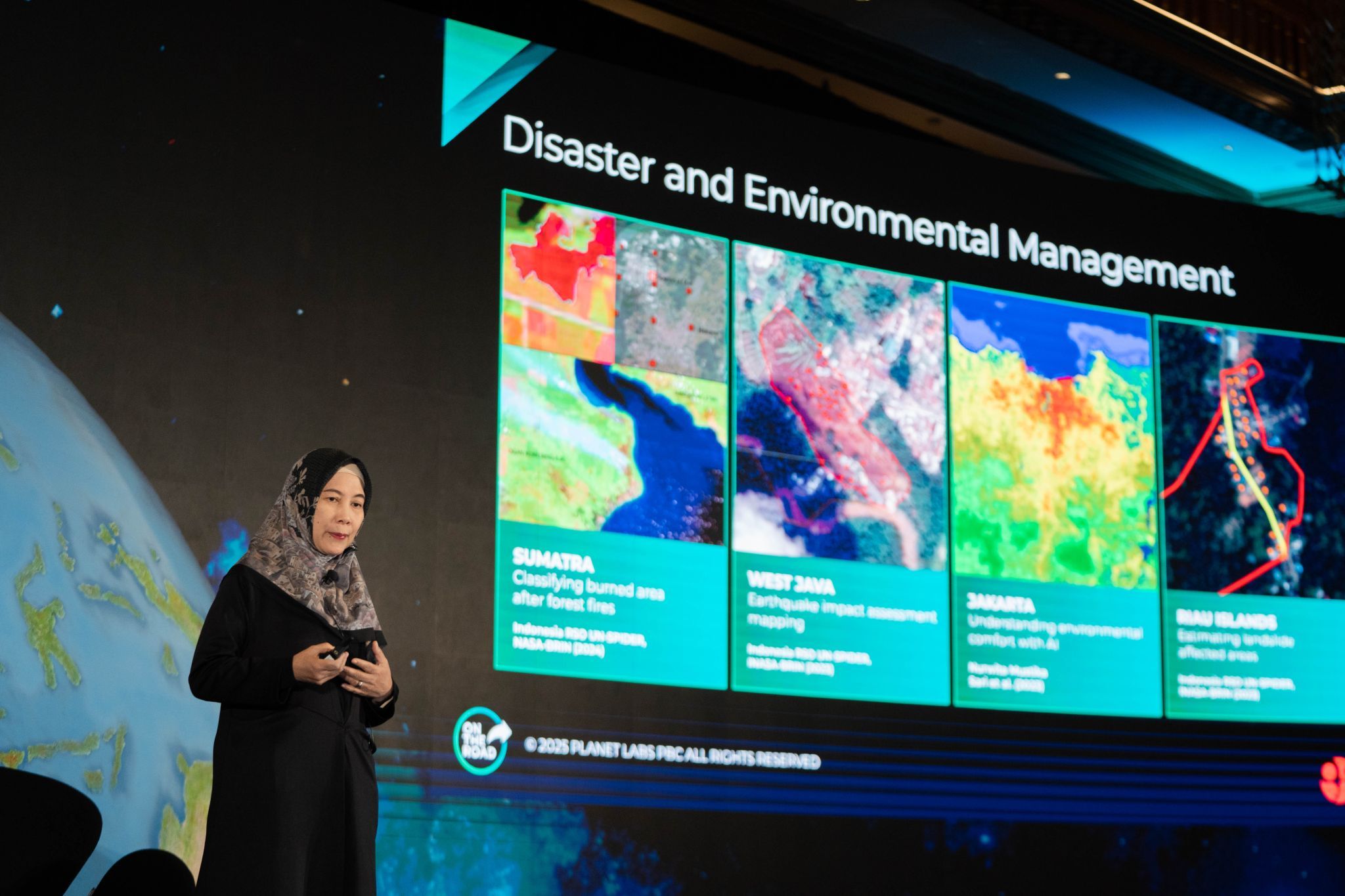
In Indonesia, EO data is currently used for a wide range of applications, from natural resource and disaster management to security and law enforcement.
By providing the foundational data and tools, BRIN acts as a key coordinator that enables different government agencies like the National Narcotics Agency and the Indonesian National Police to use EO data for real-world impact and inform policy decisions, she said.
To make EO data accessible to a wider range of users beyond data scientists, JAXA was collaborating with NASA and ESA on the Earth Observation Dashboard.
The goal is to empower users like students and researchers to analyse the data and find critical insights – like a concerning trend in the Arctic – that can lead to new research, said Dr Sugita.
This approach is proving to be successful, with new findings being generated monthly by students who were not previously engaged with this type of data, she added.
To subscribe to the GovInsider bulletin, click here.
2. Leverage platforms and AI for data sharing and actionable insights
BRIN’s Head of Research Center, Dr Muhammad Rokhis Khomarudin, highlighted that the role of artificial intelligence (AI) is two-fold: By providing a rapid way for governments to identify current issues and act quickly, as well as to forecast future events.
The synergy between EO and AI has been critical in solving pressing environmental problems in Indonesia, he noted.
The similar impact of AI was also observed in the Philippines.
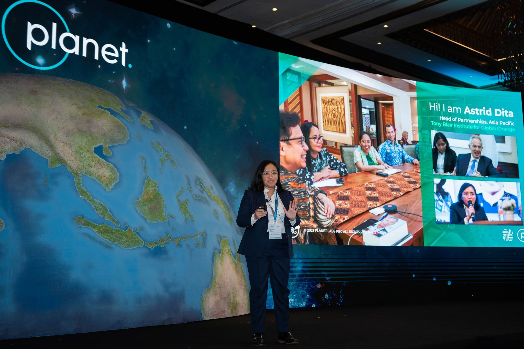
In a separate presentation, Tony Blair Institute for Global Change (TBI)’s Head of Partnership for APAC, Astrid Dita, shared how combining high-resolution satellite imagery and AI has improved the preparedness and response capabilities of the government in managing landslides.
The AI model could process close to 20 per cent of the land area coverage in just two hours, compared to 0.3 per cent of land area coverage in one week that was previously done manually.
BRIN’s Dr Adiningsih emphasised that partnering the private sector to leverage the latter’s expertise was crucial.
She noted that the private sector’s expertise in developing user-friendly platforms and utilising emerging technologies like AI to turn satellite and EO data into actionable insights for various applications.
3. Ensure secure-by-design infrastructure and foundations
Indonesian Army Electronic and Communication Corps’ Chief, Major General Iroth Sonny Edhie, shared that a reliable and secure communications infrastructure was the prerequisite for the rest of government and society to effectively use EO data and AI.
Without a reliable and secure network, government agencies could not effectively utilise these tools to enable coordinated decision-making and real-world impact, he added.
NTU’s S. Rajaratnam School of International Studies’ Professor of Security Studies, Prof Rohan Gunaratna, stressed that security professionals must understand and be able to integrate data across land, maritime, aviation, space and cyber.
He urged governments and the private sector to collaborate to bring these domains together to protect the nation and mitigate threats.
Satellite monitoring can be a powerful tool for global security, as demonstrated by the successful interception of a ship illegally transporting weapons
from North Korea.
Planet’s satellite imagery were analysed by international news outlets to track the history of weapons trade between North Korea and Russia.
Due to the global nature of today’s threats, he highlighted that public-private partnerships especially in data sharing, raising public awareness and educating specialists are essential for managing threats and ensuring global peace.
This article was made possible by partnering Planet.